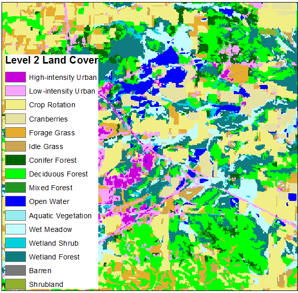
The last update in January referenced the delivery of the initial Level 1 land cover product to the Wisconsin Department of Natural Resources (DNR). The feedback received on that product was largely positive and the Wiscland 2 team has moved on to producing draft versions of the more detailed (and more complex) Levels 2 and 3 maps.
As the maps get more detailed they begin to apply more refined labels, such as distinguishing between Coniferous and Broad-leaved Deciduous forest at Level 2 or between Aspen and Red Maple deciduous forest at Level 3. The less-detailed Level 1 product had an overall accuracy of over 90% with 8 broad categories; the estimated overall accuracy is near 84% at Level 2 (with 16 classes statewide) and over 68% at Level 3 (40 classes, total). This drop in accuracy is expected as the maps become more complex and the classes more numerous.

Each map is reviewed by the DNR and comments are incorporated into the following iteration. This input allows the Wiscland 2 Team to refine processes and improve the resulting maps based on the expert knowledge available at the DNR. For example, feedback on the Level 1 product helped to evaluate wetland extent and refine how major and minor roadways are displayed in the maps going forward.
The initial Level 3 product was delivered to the DNR in late March and feedback is expected over the next several weeks. While this product is in review, the focus is on creating an initial Level 4 product for delivery in mid-May. While much has been accomplished in the past 3 months, there is still a lot to do before the project is completed in August.
For the latest project information, be sure to visit the Wisconsin Land Cover Project Page and most recent quarterly report to the DNR.
The Wiscland 2 project is a cooperative effort between UW-Madison and the Wisconsin DNR, with funding from the Federal Aid in Wildlife Restoration Program, grant #W‐160‐P‐25.
