
In the Fall of 2023, the state of Wisconsin achieved the status of having publicly accessible LiDAR elevation data for all 72 counties. But because of the processing and delivery lag time that occurs with LiDAR data projects, the twelve counties that obtained LiDAR data in 2022 have just recently been published and are now online to complete the statewide public access. As of June 2024, all Wisconsin counties have LiDAR data available online for direct download from the GeoData@Wisconsin geoportal.
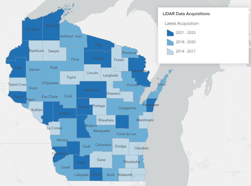
While statewide LiDAR coverage was officially obtained in 2018, some data was not made publicly accessible at that time. 2024 marks the first time all 72 counties have LiDAR elevation data that is available for direct public download online. Visit the LiDAR Status Map to view available years of data by county, or take a look at the Wisconsin Elevation Data Collection in GeoData@Wisconsin to search and download LiDAR data resources for Wisconsin.