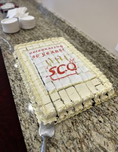
Those of you who are old enough will remember 1974 as the year Richard Nixon resigned the presidency due to the Watergate scandal. Other culturally significant events from that year include the kidnapping of newspaper heir Patty Hearst by the Symbionese Liberation Army, the opening of the World Trade Center in New York City, and use of the term “stagflation” to describe the simultaneous occurrence of inflation and stagnation of economic productivity.
1974 was quite a year!
Another significant event of 1974 — at least for Wisconsin’s mapping community — was the creation of the State Cartographer’s Office.

The driving force behind the creation of the Office was Professor Arthur H. Robinson, a faculty member in the Department of Geography at the University of Wisconsin, who began advocating for the establishment of such an office in the early 1960s. Robinson helped craft the legislation that formally created the State Cartographer position in 1973 as a special program within the University of Wisconsin. Robinson’s vision was that the State Cartographer would serve the citizens of the state through dissemination of cartographic information, preparation of special-purpose maps and coordination of mapping activities to improve efficiency.
In 1974, the Department of Geography allocated space for the State Cartographer’s Office in Science Hall and the first State Cartographer, Art Ziegler, was appointed. Staff consisted of the State Cartographer, an office assistant and part-time student clerical assistants. After Art Ziegler retired in 1990, Ted Koch was appointed State Cartographer. Koch retired in 2009, and the current State Cartographer, Howard Veregin, was appointed.
During its fifty-year history, the State Cartographer’s Office (or SCO) has been home to dozens of staff and hundreds of student assistants. The size of the Office has grown over the years and now includes staff members Ann Buschhaus, Hayden Elza, Mike Hasinoff, Thomas Kazmierczak, Jim Lacy, Howard Veregin, David Vogel and Ana Wells. The SCO also employs approximately a half-dozen student assistants working on a variety of real-world projects.
Internal funding remains a cornerstone of the university’s commitment to the SCO. In addition, over the last decade the SCO has increasingly turned to external funding sources to help advance its vision of a mature and collaborative geospatial community and well-informed citizenry. Today about one-half of the SCO’s funding is obtained externally through grants and contracts.
The SCO is a unique institution, the only office of its kind in the nation tied so closely to an academic geography department. This arrangement has fostered the values and principles of the “Wisconsin Idea” to bridge the gap between the university and citizens of the state. Through these efforts, and thanks to the vision and determination of Arthur Robinson, the SCO continues to support Wisconsin’s citizens and the state’s mapping and geospatial communities.
Learn more about the history of the SCO here.
This page gives an overview of the SCO and the activities we engage in.
For those craving even more details, search for “Annual Report” on the SCO publications page! There are now over a decade of these reports that you can view.
