
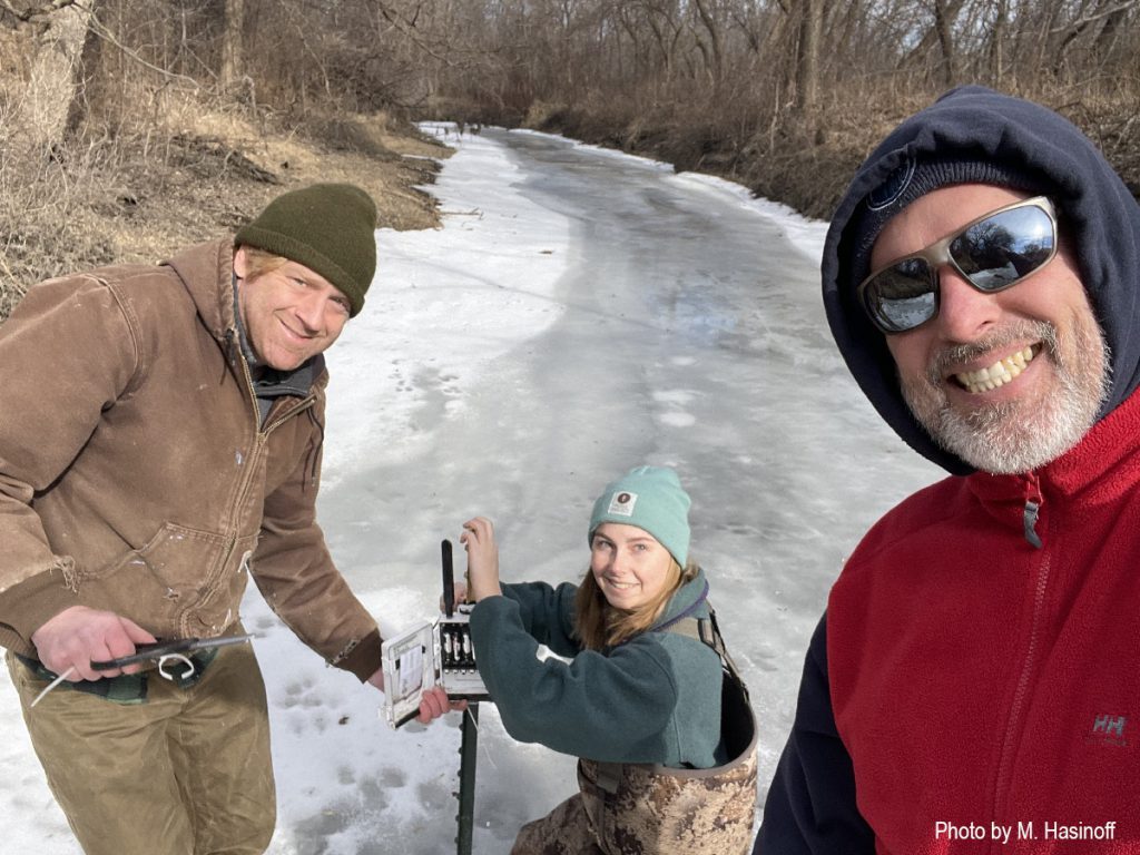
Pictured above are Matt Noone (Capital Area Regional Planning Commission), Jean Traudt (State Cartographer’s Office student intern) and Mike Hasinoff (State Cartographer’s Office staff), changing batteries in one of eight water conductivity meters in the Starkweather Creek watershed on Madison’s east side.
Thanks to funding from UW-Madison, a long-standing chloride monitoring program in the watershed has been enhanced, so that we are now able to conduct continuous monitoring at all eight locations. The monitoring system allows conductivity (a surrogate for chloride concentration) to be measured every 10 minutes. The monitoring system also shows when batteries in the monitors are getting low, which means replacing them (even in January).
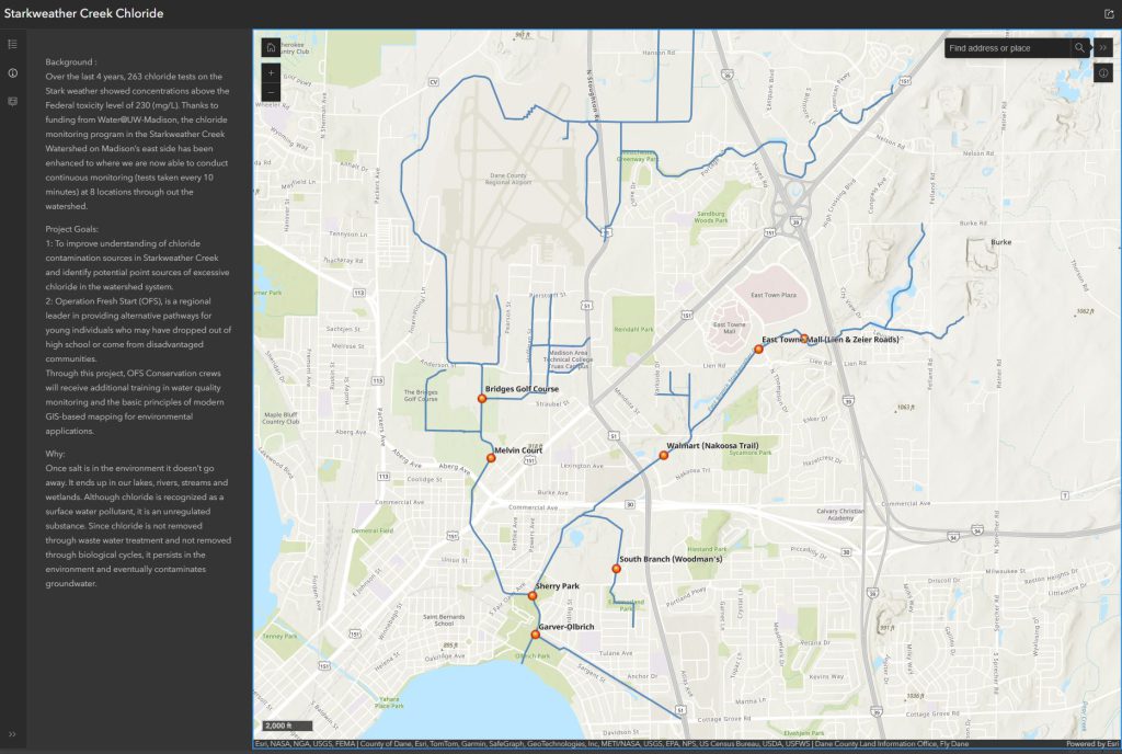
As part of his role on the project, Mike Hasinoff developed an interactive web map showing the locations of each meter. Clicking on a location brings up a graph of conductivity since late fall, 2024, when continuous monitoring began. Live updates on conductivity are available to the project team through a cloud-based service.
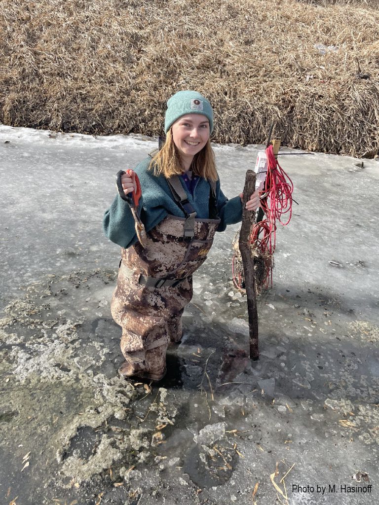
Despite the recent cold weather, the creek is not uniformly frozen. Melvin Court, the location pictured above, had about 6 inches today (January 28) — enough to walk on. The photo below shows another meter location where the ice is thin.
Jean Traudt is an undergraduate student in GIS/Cartography and Conservation Biology at UW-Madison. She has had a variety of internship experiences with the State Cartographer’s Office (SCO) and other organizations, including the Center for Limnology’s Trout Lake Station. At the SCO, she has worked on the Wisconsin Department of Transportation’s state highway map, mapping of Tribal Lands for a faculty member in the Law School, digitization of the 1930s Wisconsin Land Economic Inventory maps, and the Starkweather Creek project. A student at Madison College, Param Bhandare, is also working on Starkweather.
The goals of the Starkweather project are to establish a monitoring program for continuous chloride monitoring along the creek, engaging with stakeholders and community members to educate them about sources of chloride contamination, and beginning to establish a model for cooperation to ensure the long-term health of the creek.
Previous blog posts (here and here) have highlighted work with crew members from Operation Fresh Start (OFS), a regional leader in providing alternative career pathways for young adults. Through this project, OFS Conservation crews have received additional training in water quality monitoring and the basic principles of modern GIS-based mapping for environmental applications. A recent newsletter article by CARPC staff gives more details on the OFS training.
In addition to OFS, project partners include the Capital Area Regional Planning Commission (CARPC) and Friends of Starkweather Creek. Staff from the US Geological Survey and City of Madison are advisors on the project. The project is funded by a community-based water research grant provided by Water@UW-Madison and the University of Wisconsin-Madison’s Office of the Provost.
Students interested in a career in GIS and cartography might like to know that it’s not always just a desk job. Field work is often an essential part of the work, whether its collecting training data to make a land cover map, mapping plant communities, taking soil samples, hunting for cartographic phantoms, or changing batteries on conductivity meters in the middle of winter.
Jean reported the water to be a bit cold, but thanks to the waders, only when her hands got wet!
![]()
![]()