
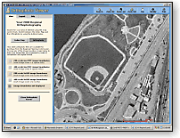
Orthophoto viewer
Orthophotos at two resolutions and other planning-related land information for an entire region of the state can now be viewed online through a single web site. This service comes from the Southeastern Wisconsin Regional Planning Commission (SEWRPC) in Waukesha. The seven counties encompassed in SEWRPC’s service area are the most densely populated region in the state and comprise roughly 5% of the state’s area.
Over its regional jurisdiction, SEWRPC is providing a limited set of geospatial data layers for viewing, including boundary reference, digital orthophotography, land use, soils, and parcels (over a limited area). For more detailed information a user is directed to web sites operated by each of the individual counties.
First impressions
The SCO staff recently took a tour of those parts of SEWRPC’s web site that deal with land information, and was impressed by much of what we saw. For starters, we appreciated the up-front advice that the mapping applications and pages operate best with a certain browser, screen resolution, and video color depth. We also liked that the viewing services are available to anyone without cost or subscription.
On the other hand, the access point to the on-line mapping wasn’t as obvious as it might have been, being listed on the SEWRPC home page as “Regional Land Information” which doesn’t convey the important fact that maps and images can be viewed directly. We also expected to find links to this new website content integrated into other pages on the SEWRPC site (e.g. Data and Publications.)
Map views and photo images
Web-mapping on the site is limited to a handful of themes: municipal boundaries, 2000 orthophotography, 2000 land use, SSURGO soils, and parcels (from three of the seven counties). With all of these layers made visible, a fairly complex map is delivered.
A person familiar with part of the region might be able to make sense of some of the layers in a local vicinity. Even so, almost anyone would be challenged when a query for information on a land-use polygon returned only a numeric code (generalized land use categories are spelled out.) One has to consult a separate PDF table of codes to determine the land use category. Similarly, a query on a parcel returns only the parcel number, and for a soil polygon only a code (such as “EtB”) is provided.
What seems clear within the regional map viewer is that the orthophotography base image is important when viewing other layers. Some of the colors used on polygons seem difficult to distinguish until the orthophotography layer is visible as a backdrop. The image also provides a lot of visual cues in deciphering land use and soil types.
Aerial imagery (the 2000 orthophotography) is viewable either through the regional map server along with other layers, or separately in conjunction with tile grids that show the areas that imagery files cover. This latter feature is especially helpful when trying to choose from the various options (two resolutions, and GeoTIFF or MrSID formats) for ordering imagery to be provided on CD-ROM ($50/disc).
Additional Help
Both the Regional Map Server and Orthophoto Viewer point to FGDC metadata about available data layers on their comprehensive introductory pages but we could not find links from within the application back out to this information. Helpful “info” tips are provided on a few layers that give additional information on currency and source. It was greatly appreciated to find links from the metadata page to NRCS soils metadata and historical soil surveys as well as SEWRPC data dictionary files for the land use information. These types of ancillary documentation helped us understand what we were seeing.
Both applications had useful Help tabs providing explicit information on how to navigate and query. We also liked the simple navigation toolbar with word descriptions on the buttons. However, the legend tabs need improvement. In our experience, legends displayed more or fewer layers than were actually displayed (or available) on the map and were not incorporated into the printable map view for reference.
Survey information, too
A final component of this newest regional land information portal is a dynamic mapping index to SEWRPC’s traditional map sheets that show information about the Public Land Survey System and geodetic control points. One can either search a database by attribute selection (e.g., Town, Range, Section, etc.) or by drawing a selection rectangle on a base map.
These queries lead to PDF files made by scanning Control Survey Summary Diagrams (CSSDs) and PLSS corner dossier sheets, both at a pleasing resolution. While the database search is fairly routine, it is the mapped Survey Document Search that may represent one of the better online mapping applications we’ve seen locally to date. There are viewable reference layers displayed and annotated in the legend, but the focus is on delivery of the scanned survey documents. A clearly numbered process helps you through map navigation and control point selection. It was nice to select multiple points from disparate areas before performing a search. Symbolization also clearly depicted which monuments had updated coordinates and which you had selected for a search.
All in all, we found this application a breath of fresh air in providing good usability and application design and continuing to raise the bar in ease of use for delivery of survey control information.
Conclusions
After our online tour, our biggest question more geared toward the near future relates to integration. SEWRPC has delivered an online regional land information portal with lots of supporting links to documentation and related content. But we see the world of web services coming and wonder where we’ll first find local information streamed into a regional context from multiple servers, the same way The National Map would like to see local and regional information bubble up seamlessly from the states. We think the series of mapping service standards developed through the Open GIS Consortium will be key to achieving this imminent level of seamless delivery of multiple scales of land information from distributed sources around the state. Only time will tell.