
Upcoming workshops showcase new redistricting tool
March 4, 2011
Six workshops scheduled during the first two weeks of April will introduce attendees to the new “WISE-LR” online web mapping application for local redistricting. 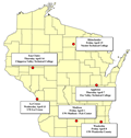
Six workshops scheduled during the first two weeks of April will introduce attendees to the new “WISE-LR” online web mapping application for local redistricting.