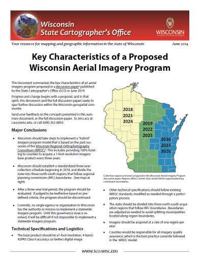
This document summarizes the key components of a Wisconsin aerial imagery program proposed in a discussion paper published by the State Cartographer’s Office. This includes recommendations for contracting, technical standards, funding, and other logistics.
Download Publication (665 KB)

