2020 US Mean Center of Population Designated at 37.415725 North Latitude, 92.346525 West Longitude
The US mean center of population continues its westward trek.
The US mean center of population continues its westward trek.
A statewide layer of 2020 census redistricting data for over 200,000 blocks is now available on Geodata@Wisconsin.
The acronym “MCD” is commonly misused. Here’s the correct interpretation from the Census Bureau.
Wisconsin counties that are not yet participating in the Census Bureau’s County Consolidated Boundary & Annexation Survey (C-BAS) Program have 90 days left to sign up before the August 1, 2014 deadline for the 2015 Boundary and Annexation Survey.
Tune in on November 21st to learn more about the U.S. Census Bureau’s County Consolidated Boundary and Annexation Survey.
The U.S. Census Bureau is encouraging Wisconsin counties to consider participating in their County Consolidated Boundary and Annexation Survey (C-BAS). The deadline to participate is August 1.
One of the more common questions we get at the SCO is “Where do I find ‘the’ school district map of Wisconsin?” The answer is more complicated than you might think.
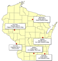
Six workshops scheduled during the first two weeks of April will introduce attendees to the new “WISE-LR” online web mapping application for local redistricting. 
The U.S. Census Bureau is conducting the Boundary and Annexation Survey (BAS) to update their records regarding changes to legal boundaries, names, and governmental status of all governmental units.
On March 21 we announced a series of U.S. Census Bureau “LUCA” workshops. Registration information is now available for additional dates and locations.
