Examples of Database Applications
The Historic Landcape database includes information about the species and size of trees at every half-mile and one-mile corner in the state; observations about soils, vegetation, and ecosystems; and notes on features such as timber areas, ore outcroppings, and general suitability of the countryside. It includes notation of Indian gardens, villages, and trails, and any other cultural features encountered. It is a unique resource and has been used widely by university researchers, consultants, Department of Natural Resource staff, Wisconsin Native Tribes, conservation organizations, and private individuals.
We envision making the Historical Landscape database even more widely available and accessible to a broader audience. Identifying new users and new uses is the primary goal of the community forum study.
The links below are examples showing how the Historic Landscape database has been used to support research, planning, resource management, education, and outreach. We hope that these examples will inspire you to think of other uses for the database that align with your own needs.Do you have something to share?
Do you want to contribute a map or report to this website, or share some ideas about potential uses?
If so, please contact us.
MAPS
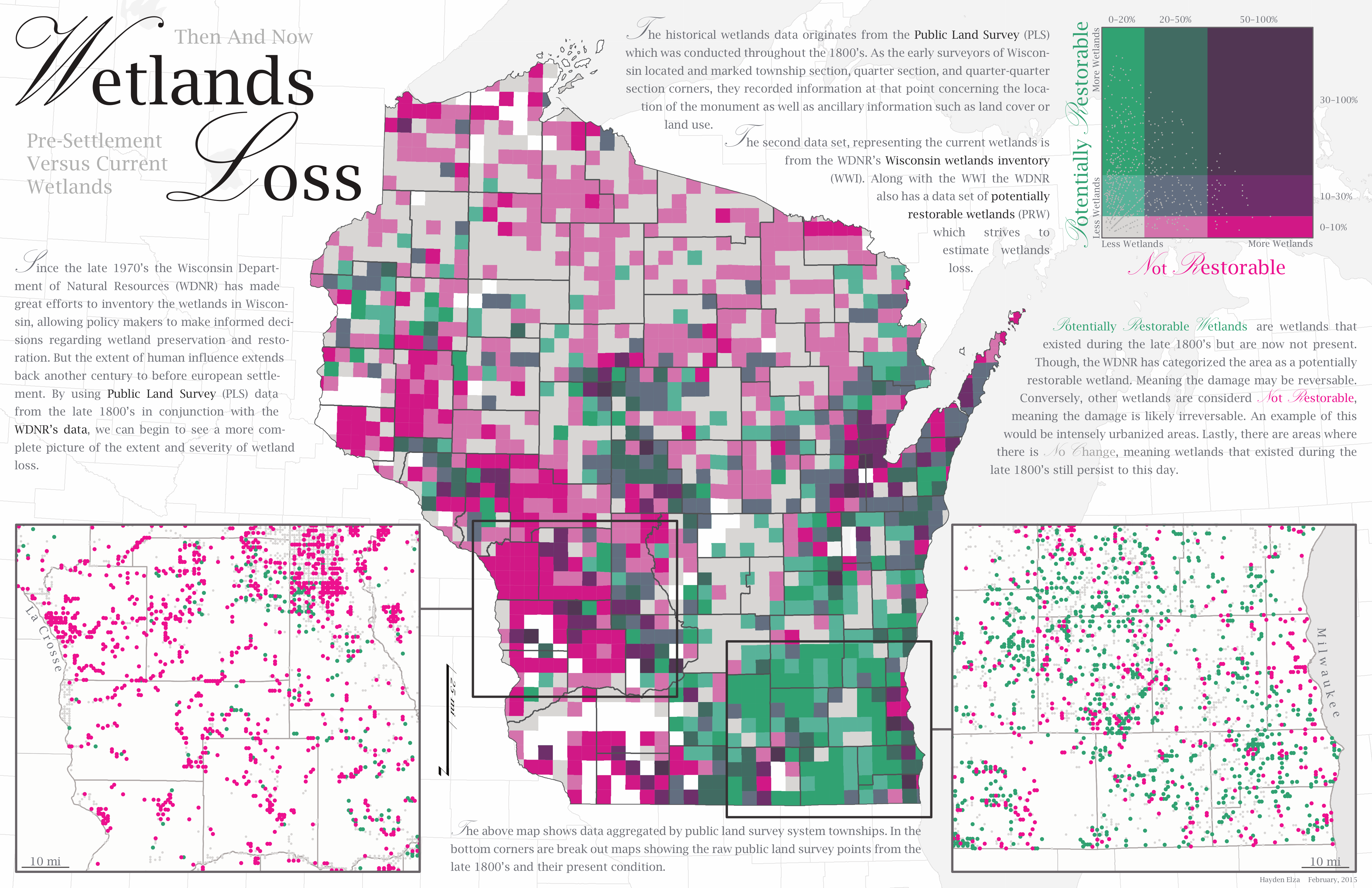
Wetlands Loss in Wisconsin Map (student project by Hayden Elza)
Bay Shore Blufflands Master Plan Map (Courtesy of Nancy Aten and Dan Collins)
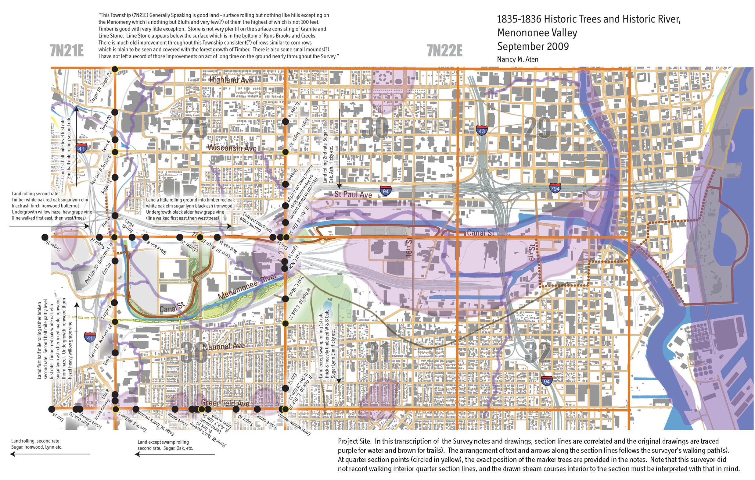
Menomonee Valley Restoration Plan (Courtesy of Nancy Aten)
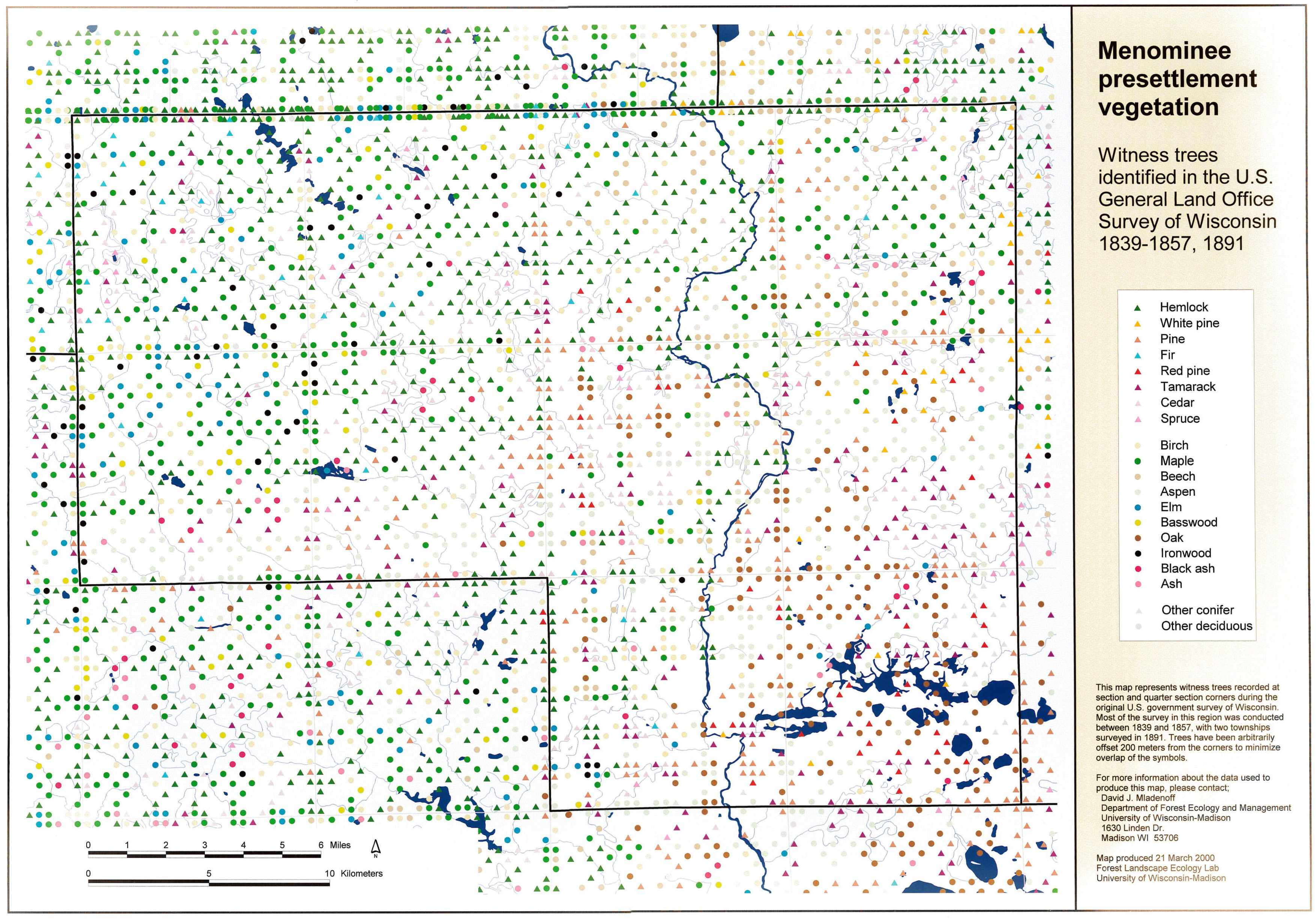
Menominee Presettlement Vegetation Map
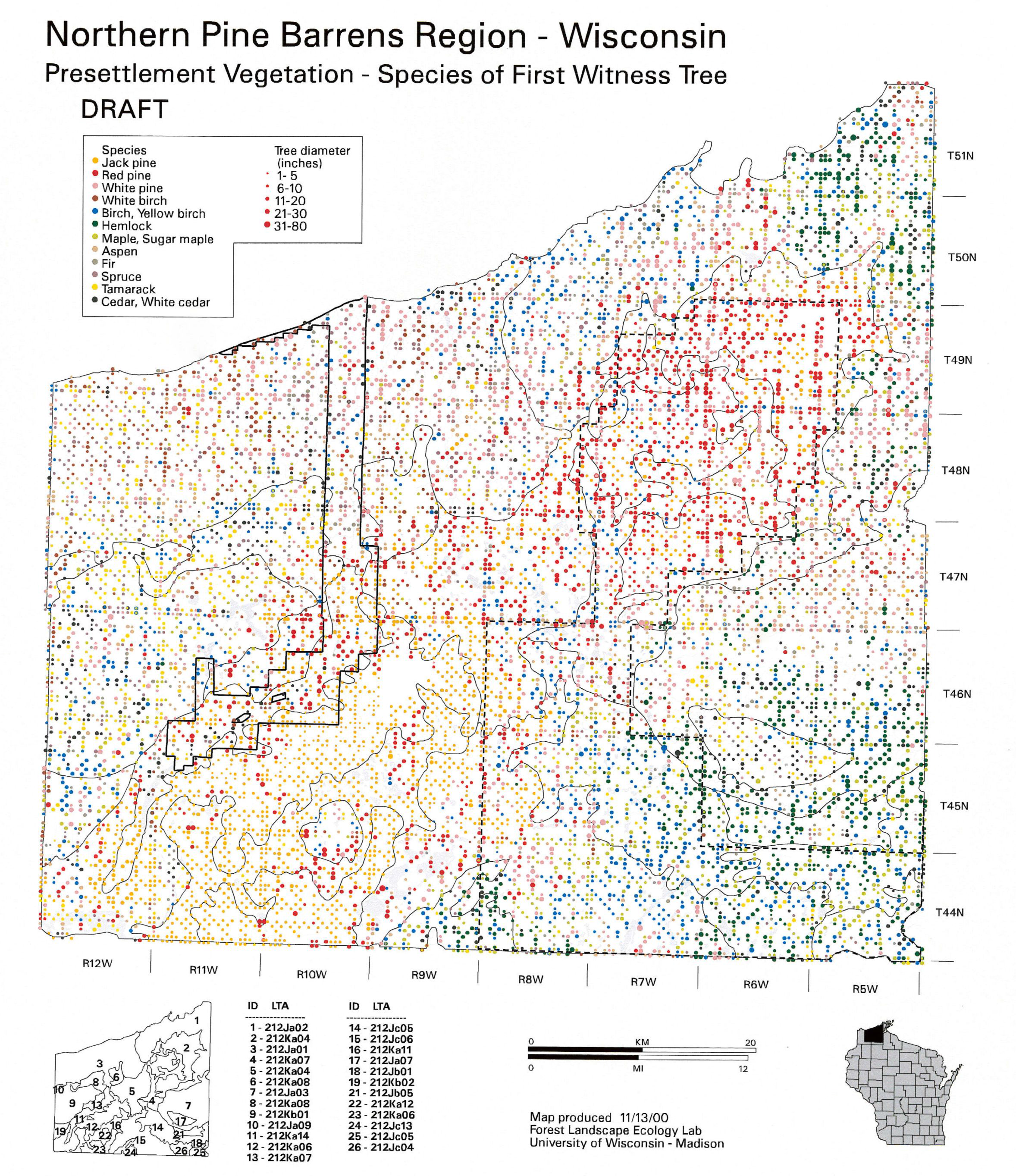
Northern Pine Barrens Witness Tree Species Map
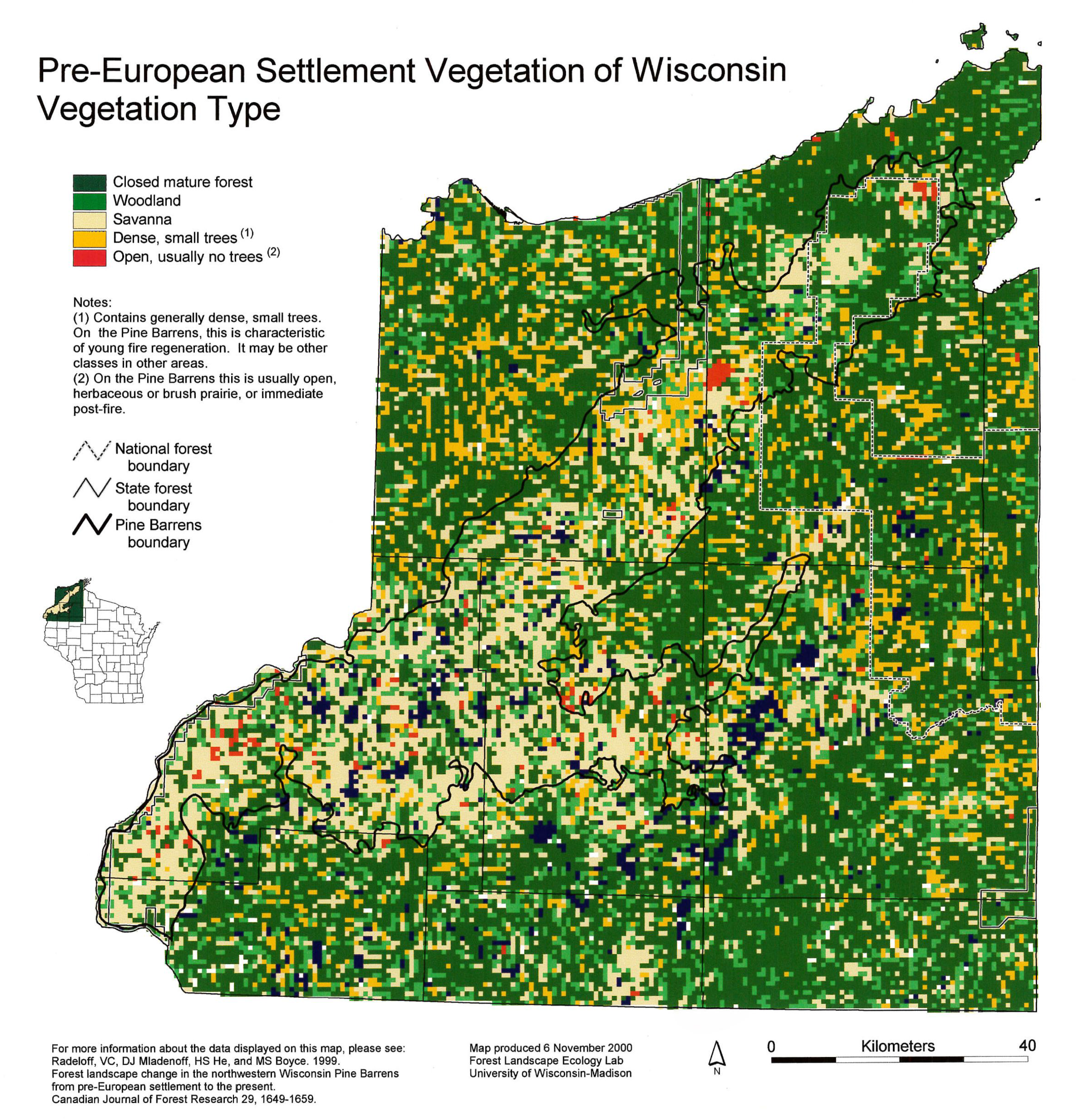
Northwest Wisconsin Pre-European Vegetation Map
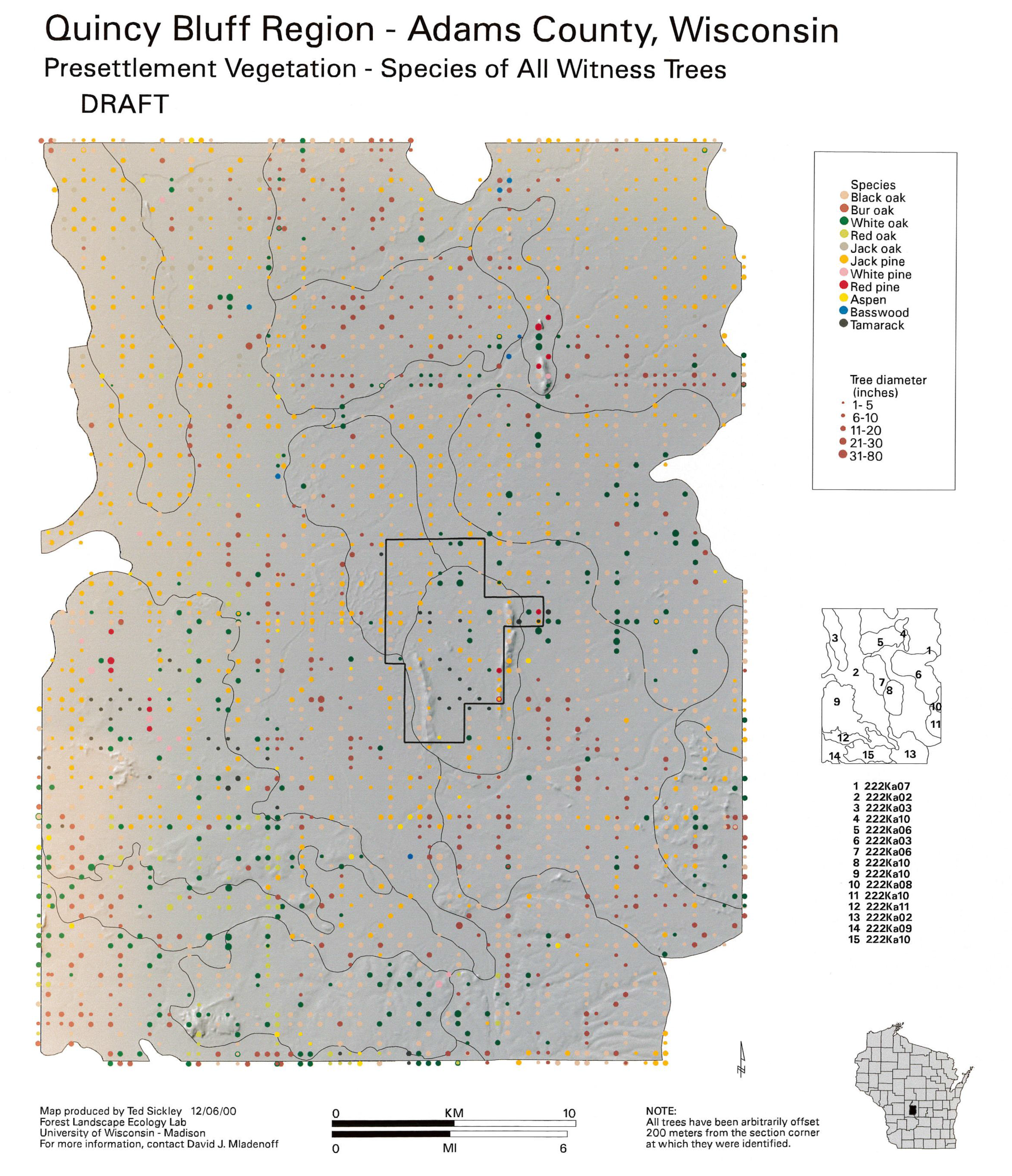
Quincy Bluff Witness Tree Species Map
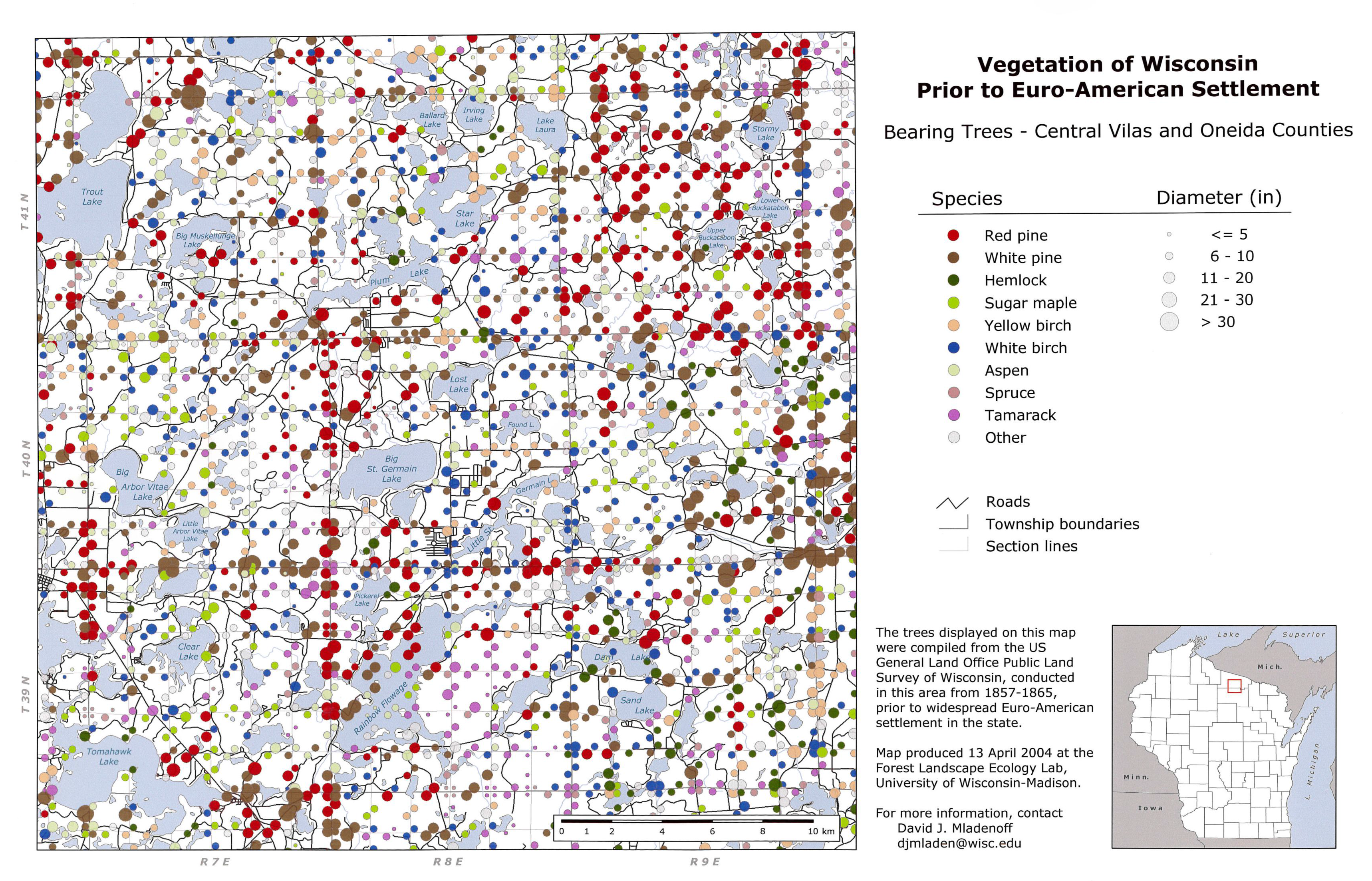
Vilas and Oneida Counties Bearing Tree Species Map
Washburn County Presettlement Vegetation Map
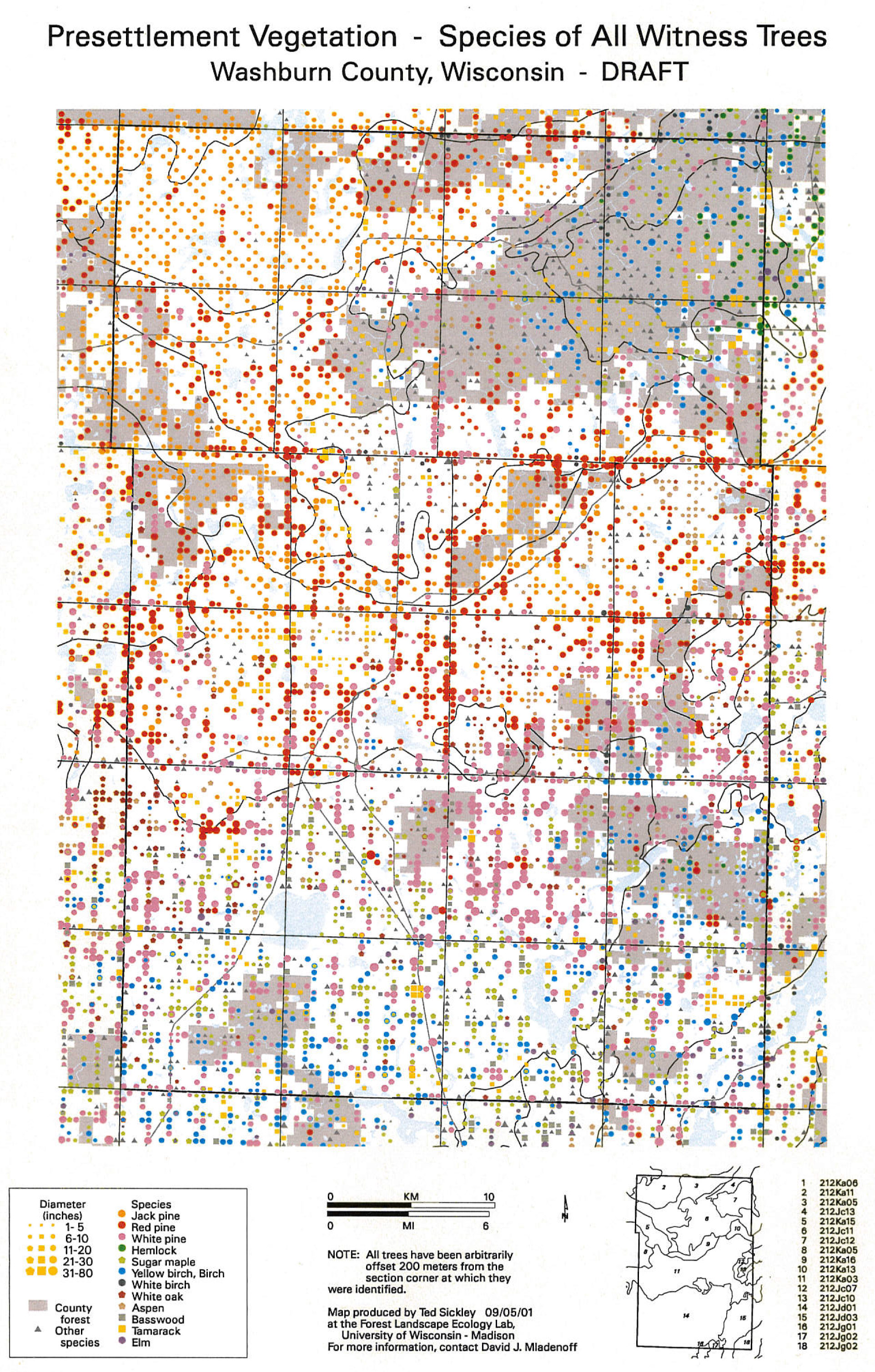
Iron County Presettlement Vegetation: Dominant Species Map
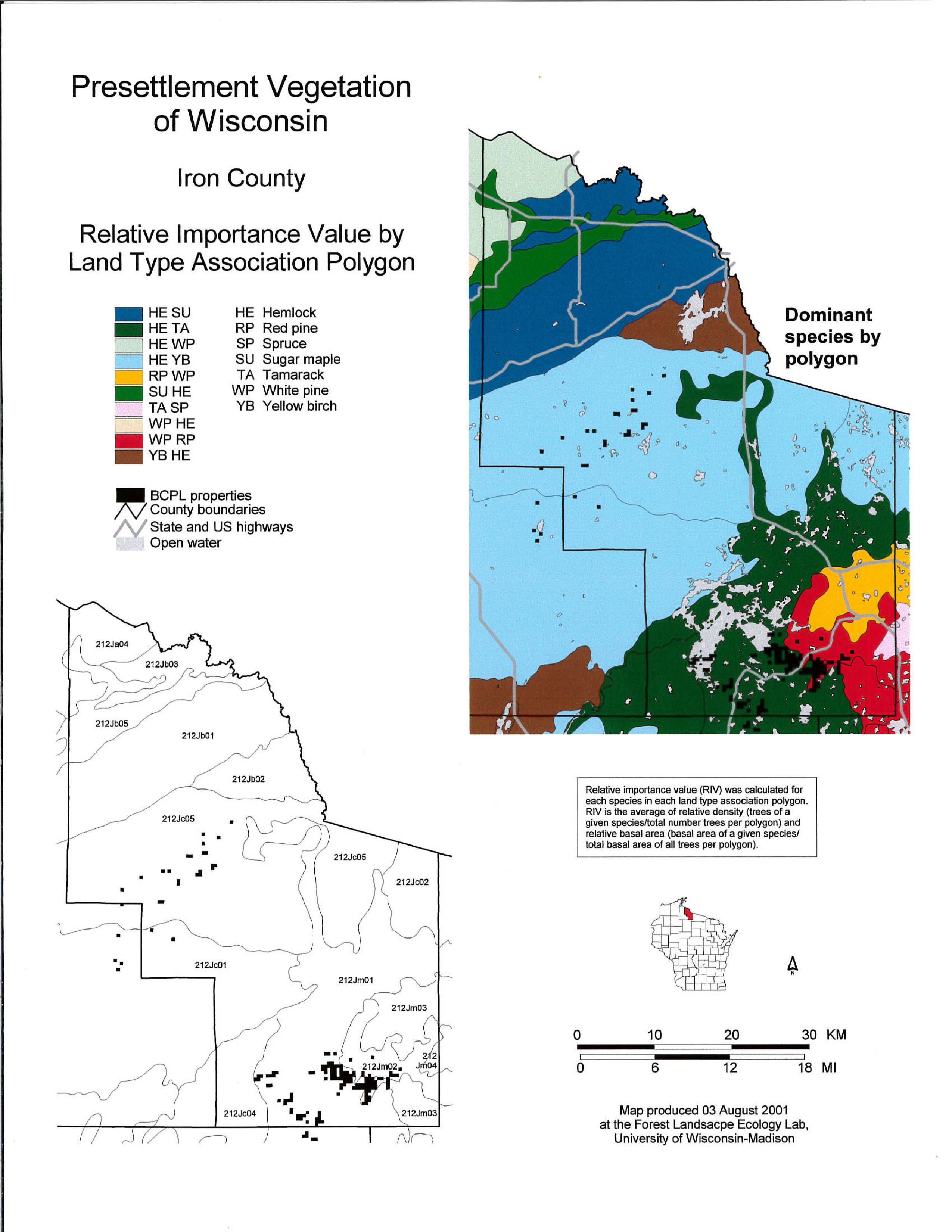
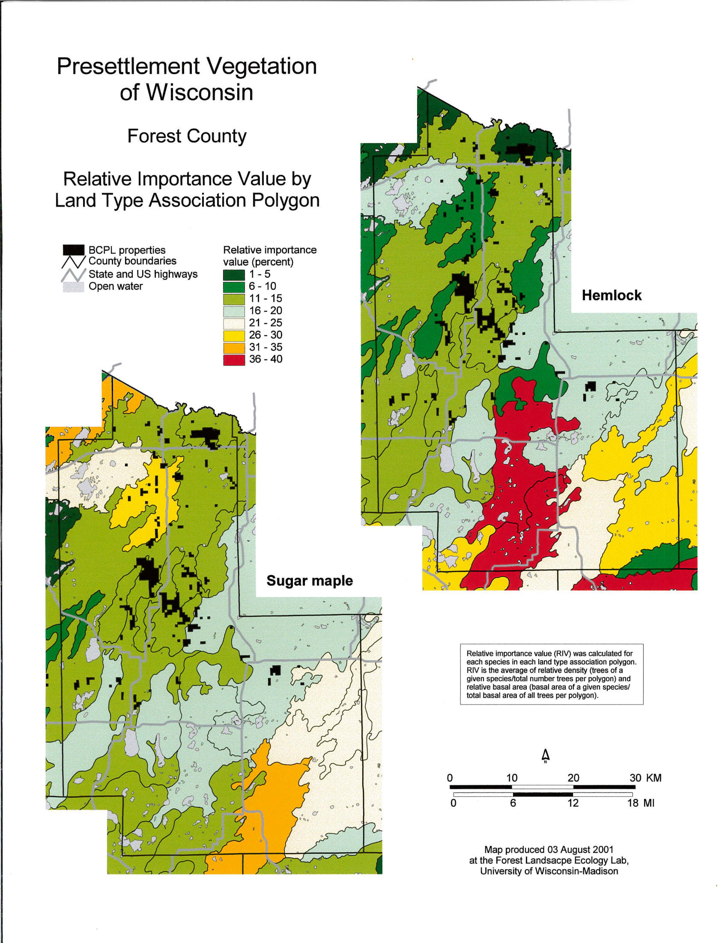
Forest County Presettlement Vegetation: Species Relative Importance Map
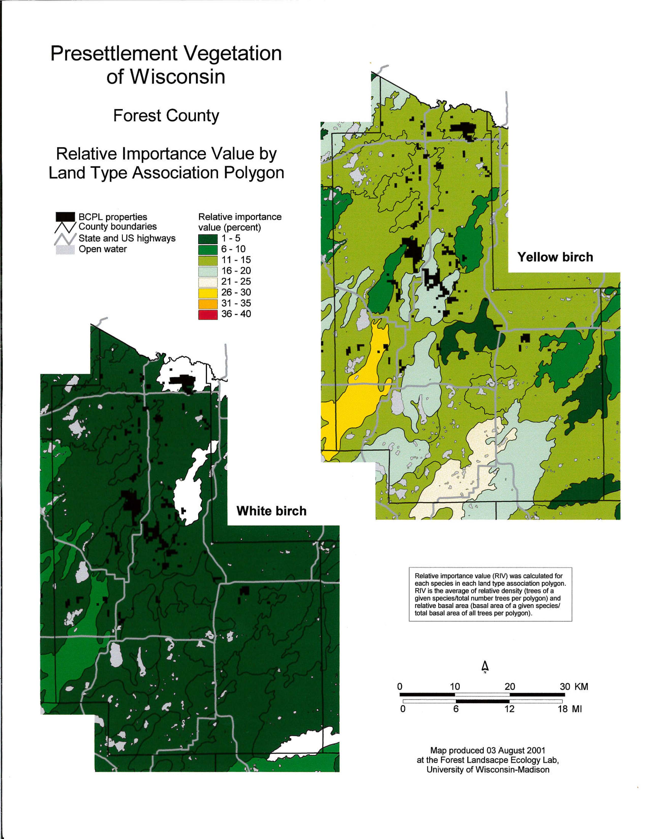
Forest County Presettlement Vegetation: Species Relative Importance by land Type Map
ARTICLES AND REPORTS
See Wisconsin through the Eyes of 19th Century Surveyors (WDNR publication)
The Original US Public Land Survey Records (Schulte & Mladenoff, Journal of Forestry)